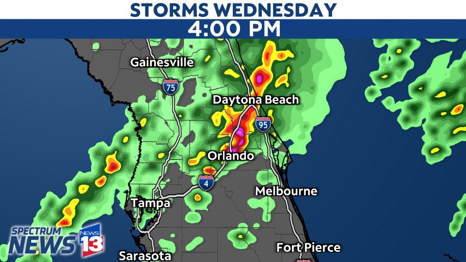
A second batch of storms are moving through Central Florida this afternoon. A Severe Thunderstorm watch has been issued for Central Florida until 8 p.m.
The severe thunderstorm warnings for southern Brevard County and Volusia County have both expired.
Sign up for severe weather alerts
A cold front heads toward Central Florida Wednesday afternoon, and this will be the trigger for another round of storms on Wednesday.
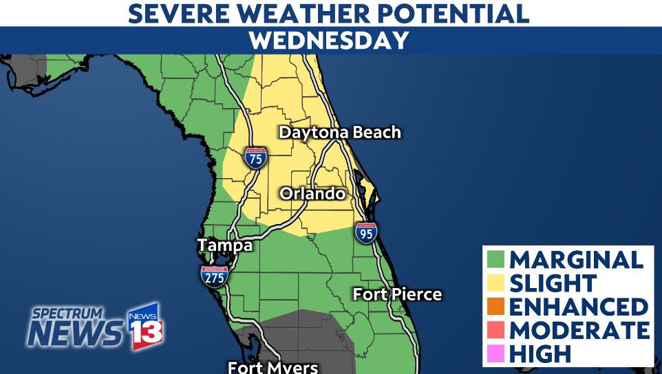
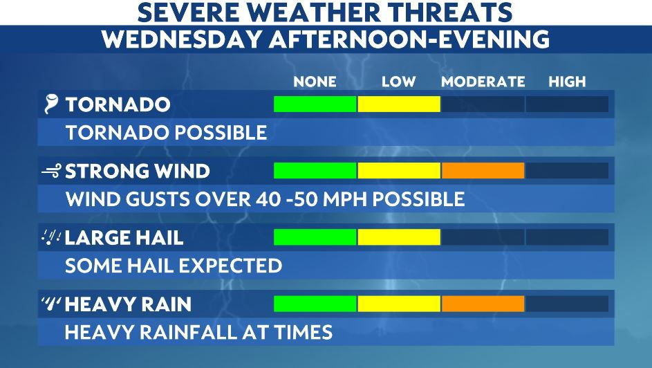
Downpours, gusty winds, hail and an isolated tornado are all possible again. They'll likely develop from the west and push eastward.
The time frame looks to be around noon and they will last until 7 p.m. or 8 p.m. Wednesday.
Hail is a possibility with the storms on Wednesday. This is the time of the year we generally can see hail form in Central Florida.
It is best to have multiple ways to receive severe weather alerts in case a storm impacts your neighborhood.
One way is to download the Spectrum News App. Once you download the app, go into the settings and turn on the notifications for weather alerts.
Another way is to have a NOAA Weather Radio. This will alert you of any warnings that the National Weather Service may issue for your area.
Of course, our team of dual-certified meteorologists will track the storms through the day, live on Spectrum News 13.