


CAPE CANAVERAL — While the launch was successful, Astra's attempt to deploy NASA’s weather satellites for the TROPICS-1 mission failed on Sunday, meaning they are a loss, confirmed NASA.
What You Need To Know
- Two TROPICS weather satellites have been lost
- Both the FAA and Astra will launch an investigation to what happened
- The goal of the mission is to improve the scientific community's understanding of tropical systems
- The launch was at 1:43 p.m. EDT
- Learn more about the TROPICS weather satellites
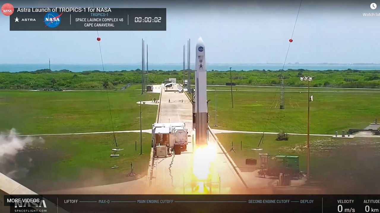
The 43-foot Rocket 3.3 launched from Space Launch Complex 48 at Cape Canaveral Space Force Station Sunday at 1:43 p.m. EDT.
The target orbit for the two TROPICS satellites was 550 kilometers (about 342 miles) at altitude, but before Astra removed its launch display during its live feed broadcast, it showed they climbed to 570 kilometers (about 354 miles).
“We had a nominal first stage flight, however, the upper stage engine did shut down early and we did not deliver our payloads to orbit,” said Amanda Durk Frye, Astra’s first stage and engine production senior manager, before the live broadcast ended.
Astra tweeted out nearly the same message.
We had a nominal first stage flight. The upper stage shut down early and we did not deliver the payloads to orbit. We have shared our regrets with@NASA and the payload team. More information will be provided after we complete a full data review.
— Astra (@Astra) June 12, 2022
In a press release, NASA confirmed the two TROPICS satellites — designed to provide more accurate and faster updates of tropical storms and hurricanes — were lost.
On Sunday afternoon, Spectrum News 13 reached out to both NASA and Astra for comment and they have not yet returned messages.
Neither NASA nor Astra has yet stated what was the cause of Sunday’s failed deployment of the satellites.
Because this was an FAA-licensed mission, both the FAA and Astra will investigate what happened during the launch, NASA stated.
Astra is part of NASA’s Earth venture program that gives companies the chance to participate in “lower-cost, higher risk missions.”
“As the agency works with emerging launch providers for cost-effective launch capabilities to space, these types of missions are important to expand our scientific knowledge while fostering the U.S. commercial launch industry,” NASA stated.
There were a total of six TROPICS satellites, but now there are four left. They were scheduled to launch later this year, but it is expected that those launches will be pushed back while the investigation is underway.
This is the second time this year that Astra has failed to deploy satellites for NASA. In February, Astra had a successful launch of its Rocket 3.3, but could not deliver six CubeSats into orbit. The goal of the mission is to improve the scientific community's understanding of tropical systems.
Due to the nature of the mission, it was ironic that on Sunday the 45th Weather Squadron was giving between a "60 → 90%" of favorable weather for the launch because of concerns of cumulus clouds, lightning and surface electric fields.
NASA has strict weather rules and criteria that must be met for launches. The launch was supposed to go off at 12 p.m. EDT, but it was going to be pushed back to Monday but eventually, it was decided the launch would continue on Sunday.
Understanding TROPICS
What was going up would have been the first of three launches for NASA’s Time-Resolved Observations of Precipitation structure and storm Intensity with a Constellation of Smallsats (TROPICS) mission.
It is to help give more detailed and faster updates of major storms.
“Many weather satellites will generally measure a storm only once every few hours, leaving gaps in coverage where a storm may quickly strengthen. To help fill this observation gap, NASA is launching TROPICS,” the space agency explained in a video.
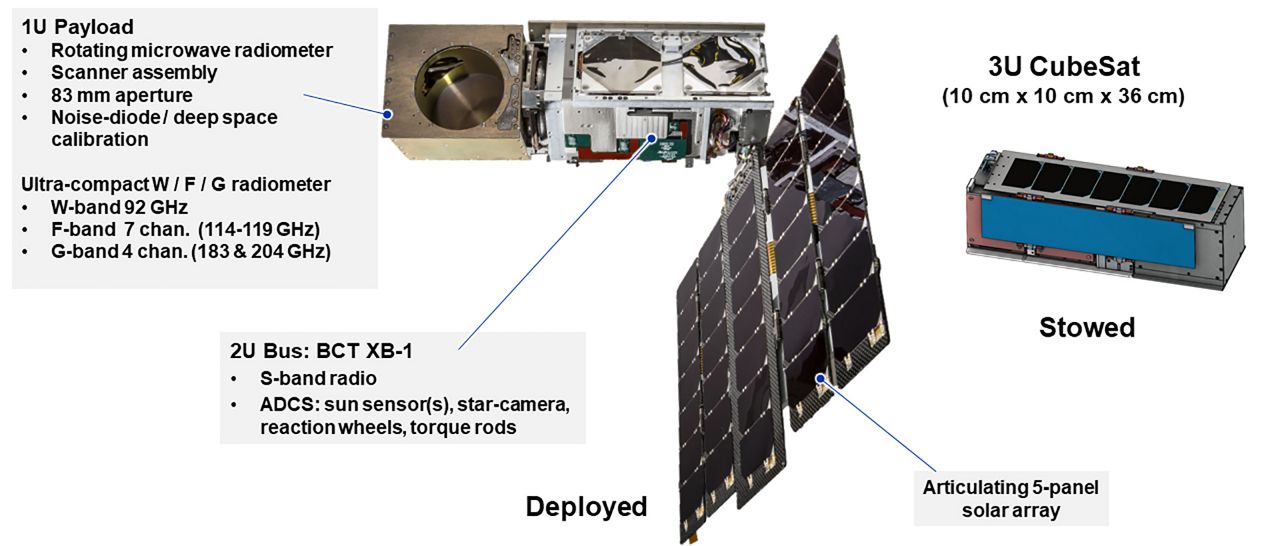
TROPICS will eventually release four small satellites about a foot long each and their mission is simple: “To provide near-hourly observations of a storm’s precipitation, temperature, and humidity.”
The plan for Sunday’s launch was for only two of the TROPICS satellites will be lifted off, with two more launches anticipated for this year.
Once all four satellites have been launched, they will pair off and cover different low-Earth orbits about 30 degrees above the equator, an area where most storms usually generate.
“This will maximize the amount of time the satellites spend passing over the part of Earth where most tropical cyclones form — a horizontal band stretching from about the Mid-Atlantic region of the United States to the southern coast of Australia, roughly between 38 degrees north and south latitudes. Ideally, one of the TROPICS satellites will pass over any given area within that band about once an hour,” NASA explained.
How the TROPICS work
Onboard each TROPICS satellite is a microwave radiometer — developed by MIT’s Lincoln Laboratory researchers — that can measure microwave frequencies from 90 to 205 gigahertz. These frequencies help show the temperature, precipitation, moisture and other characteristics of a storm and the surrounding atmosphere, according to NASA.
Because certain frequencies give off a certain amount of heat and light at different altitudes, they help the TROPICS satellites create a three-dimensional image of a storm’s environment, NASA stated.
The TROPICS and current weather satellites will help meteorologists understand how tropical storms and hurricanes develop.
“The satellites will provide enhanced imagery of developing systems, especially in the open Atlantic. This imagery will help us better understand the development of tropical storms and hurricanes thousands of miles away, as well as help create more accurate forecasts of tropical systems for Florida,” said Spectrum News 13 meteorologist David Heckard.