


ORLANDO, Fla. — Humberto is expected to make a northeast turn sometime on Monday. A few coastal showers will be possible overnight, with lows in the mid to upper 70s tonight.
- Highs in the middle to upper 80s
- Bring the rain gear just in case
- Send us your weather photos and get the latest forecast via the Spectrum News 13 app
- CURRENT CONDITIONS: Temperatures, heat indexes, trends
- SEE BELOW: See our 7-day forecast ▼
- CALCULATE: How hot can your vehicle get? ▼
Lower rain chances arrive for Monday.
Temperatures will begin to climb back into the low 90s tomorrow as Humberto moves away from Florida and the drier air behind it moves in.
Widely scattered showers are expected, with the best chance along the I-95 corridor.
- View LIVE Interactive StormTracker 13 Radar Map
- View our LIVE Sky 13 Weather Cameras
- Sign up for Severe Weather Alerts
Tuesday is expected to be mostly sunny with minimal rain chances. Increased sun means our high will be in the low to mid 90's.
The coastal areas will be in the upper 80s but inland it will be in the 90s.
Tropical Update
We continue to watch an area in the open Atlantic. This is a high chance for development and could be a tropical depression later this week. It could impact the northern Lesser Antilles late week.
There is also a second system in the central Gulf of Mexico. It is very disorganized and has a low chance of development.
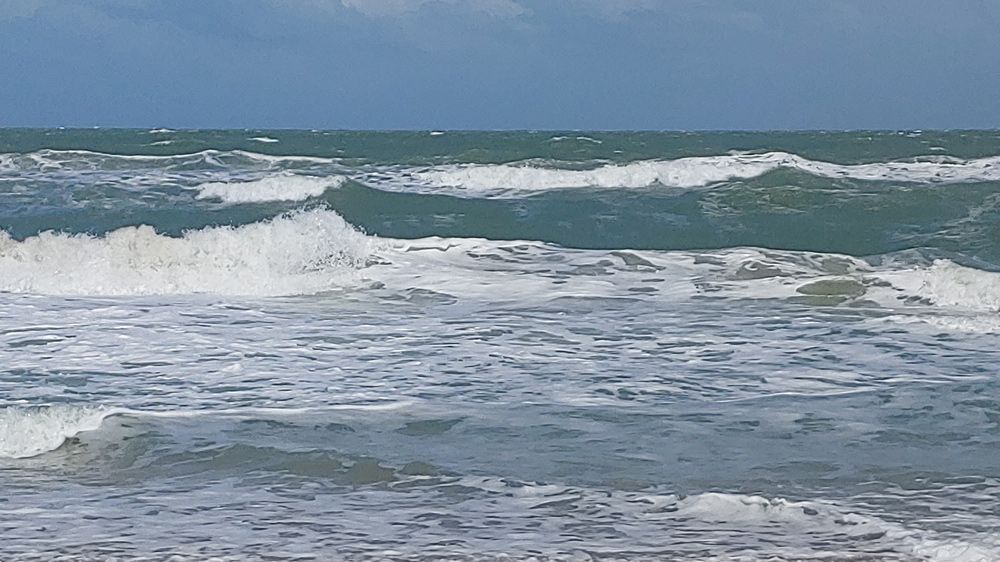
Beach and Surf Conditions
Surfing conditions will be poor-to-fair tomorrow with wave heights of 4 to 6 feet. There will be continued storm wells with an east-northeasterly swell mix.
Water temperatures are in the low to mid-80s. The rip current risk is high. It is not recommended that anyone get in the water. If you do get in, always swim near a lifeguard and never alone.
Hazardous boating conditions continue today as Humberto is moving north, past the east coast of Florida. There is a Small Craft Advisory through Monday evening.
Winds are coming out of the north at 15-20 knots with higher gusts. There is a chance of scattered showers with isolated thunderstorms throughout the day. Seas will be around 6 to 9 feet with choppy waters on the intracoastal tomorrow.

We want your pictures!
Show us what the weather looks like in your neighborhood. Your photo could end up on Spectrum News 13.
- Get the Spectrum News 13 app for iOS or Android
- Tap "Submit Content" at the bottom of the app menu
- Remember to include your name and location