ORLANDO, Fla. — The calendar may say it is February, but the temperatures over the past week are more typical of late April and early May in Central Florida.
- Afternoon temps nearly 10-15 degrees warmer than average
- Through February 20, Orlando has felt ten 80 degree days
- MORE: Spectrum News 13 Weather Experts Blog
Afternoon highs have been running nearly 10 to 15 degrees warmer than average, and the same goes for our morning low temperatures, which have only been dropping into the 60s.
So what is going on?
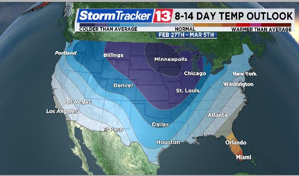
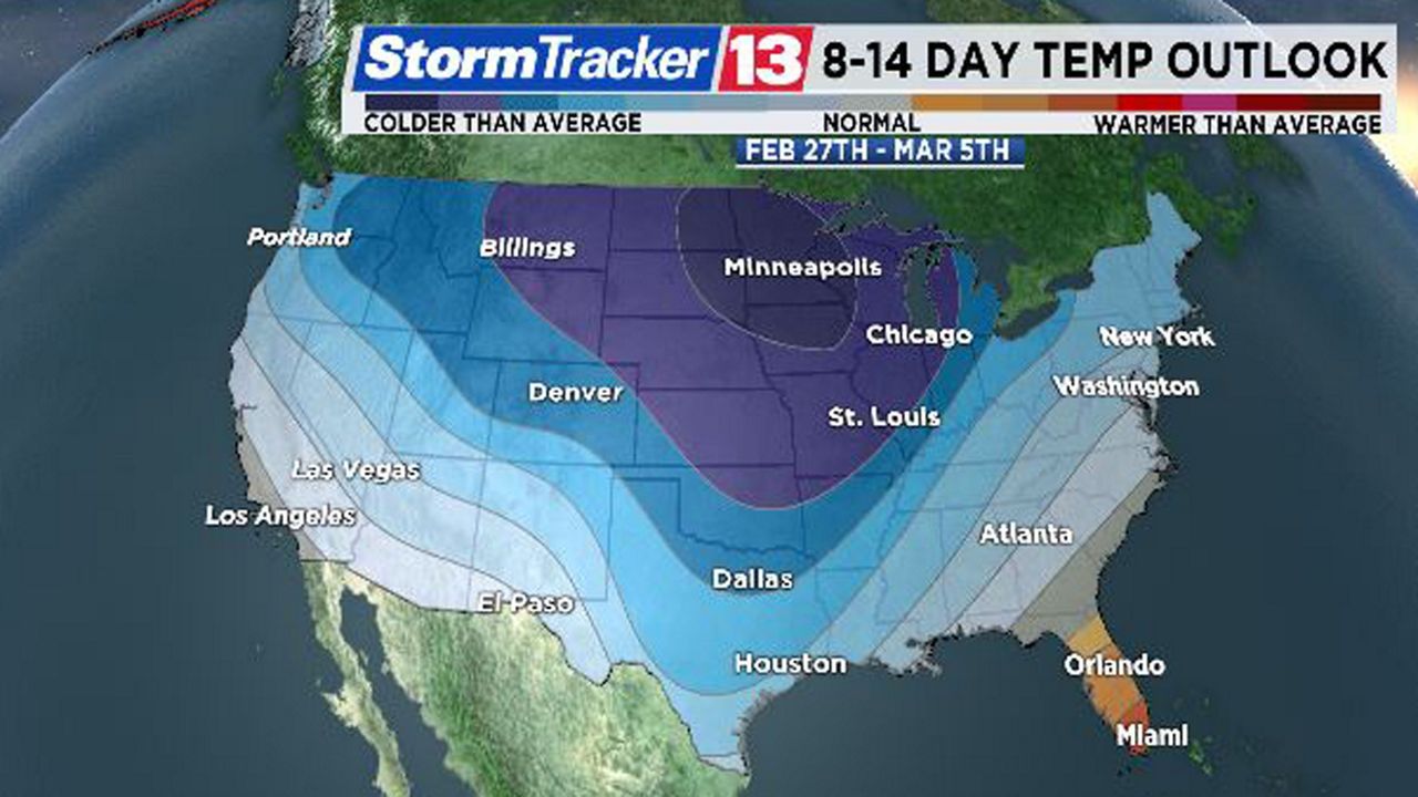
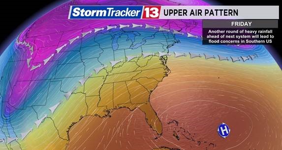
Well, the overall weather pattern across the country has become pretty stagnant. Over Central Florida and most of the southeast, a ridge of high pressure has developed, and this high has been in control of our weather for a better part of a week.
Meanwhile, a trough (or huge dip in the jet stream) is sitting over the Midwest and Mountain West states. This dip in the jet stream is steering more winter storms from the West Coast into the Midwest and Northeast this week.
This kink in the jet stream is also sending the colder air into the rest of the country, while Florida feels the warmer than average temperatures thanks to the ridge of high pressure.
A few cold fronts have made their way into the southeast into places like Alabama, Mississippi, and Georgia, but thanks to Central Florida’s close proximity to the high pressure system, just off the Atlantic coast, these fronts have had little to no influence on our weather.
So the shots of cool air we were once getting at the end of January have since stopped. This huge ridge of high pressure is essentially acting like a barrier in keeping the colder weather out of the region.
Through February 20, Orlando has felt ten 80 degree days. Our average high during this month ranges from 72 degrees to start up to 76 degrees by the final few days. Last February, Orlando had fourteen 80 degree days and a total of twenty-two 80 degree days at the end of it.
The average number of 80 degree days in Orlando in any given February is about nine. Both 2018 and 2017 experienced an abnormally large number of 80 degree days and those years also finished in the top 10 warmest Februarys on record in Orlando.
In fact, February 2018 was the warmest on record in Orlando, and 2017 was the 8th warmest on Record. There’s still a ways to go in this year’s February, but it is also on track to be one of the warmest on record (records for Orlando date back to 1892).
There were only seven 80 degree days in Orlando in 2016 and just three in 2015.
While it is not uncommon to feel these types of temperatures in February, it is still unusually warm for this time of the year.
Long range climate outlooks continue to show warmer than average temperatures continuing through the end of February with wetter than average conditions expected for the end of the month.