


We have our first landfalling system of (before) the season.
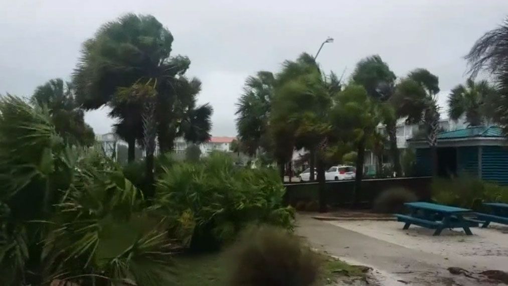
Subtropical Storm Alberto made landfall in the Florida Panhandle Monday as a weakened subtropical storm.
- GET WEATHER ALERTS: Sign up to receive weather text alerts from Spectrum News 13
- Alberto made landfall on Laguna Beach in Florida
- Official start of Atlantic hurricane season isn't until June 1
- RELATED:
- TRACK ALBERTO:
- Desktop and mobile web users: Jump to Interactive Tracking Map ▼
- App users: Go to StormTracker 13
Alberto made landfall at Laguna Beach in Florida, and is expected to weaken rapidly.
The latest advisory now has Alberto with winds of 35 mph. The center is located 50 miles west-northwest of Dothan, Alabama.
Alberto is moving north at 12 mph with a minimum pressure of 996 mb.
Now that Alberto is over land, weakening to a depression is expected overnight and a remnant low Tuesday afternoon as it continues to move north toward Tennessee. Flooding will be a concern for the Gulf Coast and as far north as Indiana where Flash Flood Watches have been issued.
Tropical Storm Warnings continue from the Aucilla River to the Alabama/Florida border.
A Storm Surge Watch is also posted for areas between the Aucilla River and Mexico Beach.
Alberto remains a broad system. Some areas of the Florida Panhandle, eastern Alabama and western Georgia could receive 4-8 inches of rain, with isolated higher totals.
Tropical-storm force winds will continue in the Panhandle. The combination of Storm Surge and the tide will cause normally dry areas near the coast to be flooded by rising waters mov ing inland.
Tornadoes are also possible tonight over parts of Georgia and southeast Alabama.
For Central Florida, showers and storms are moving through at this time with gusty wind possible. We’ll keep a chance for more to develop into early tonight, then only an isolated shower heading into Tuesday morning.
With moisture sticking around, afternoon showers and storms will be likely the next few days as temperatures climb into the mid to upper 80s. Humidity will be extremely high, making it feel more like the low 90s.
The system developed Friday morning near the northwestern Caribbean Sea. A subtropical storm means the center of circulation is exposed and the rain and thunderstorms are pushed away from the center. The highest winds are also away from the center.
Alberto is the first named storm in the Atlantic in 2018. Hurricane season in the Atlantic basin officially begins on June 1.