


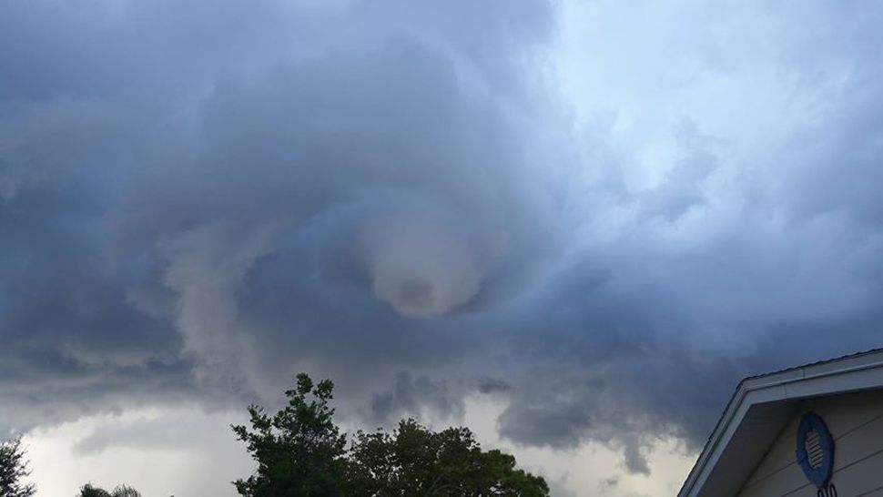
ORLANDO, Fla. — Hail pummeled cars, jammed traffic, cracked windshields, and tore through screens and awnings across Central Florida on Wednesday morning.
- Hail cracks windshields, causes transit delays
- Sunny, warmer weather on Thursday
- RELATED: Brevard Humane Society Seeks Donations to Repair Hail Damage
- Send us your weather photos via the Spectrum News 13 app
- CURRENT CONDITIONS: Temperatures, heat indexes, trends
- SEE BELOW: See our 7-day forecast ▼
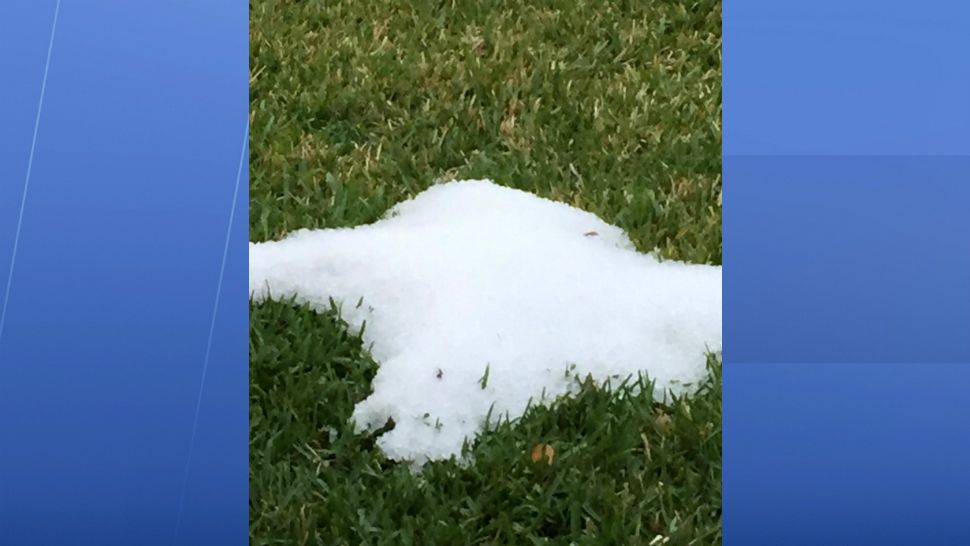
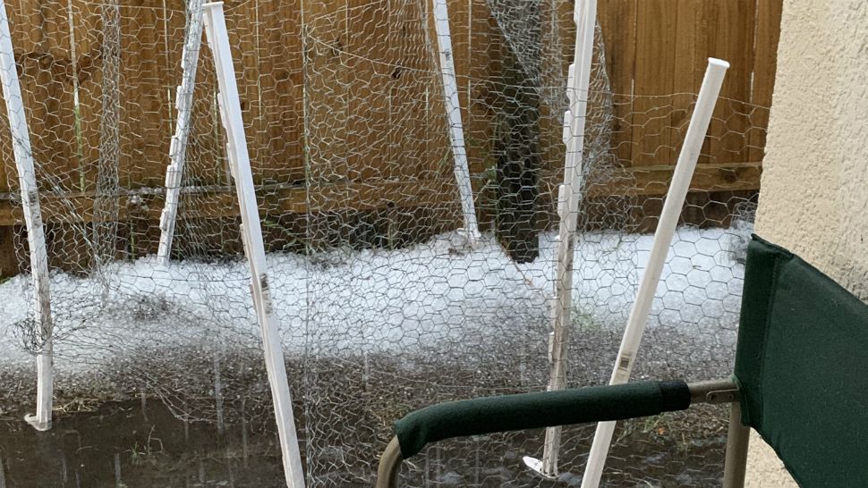
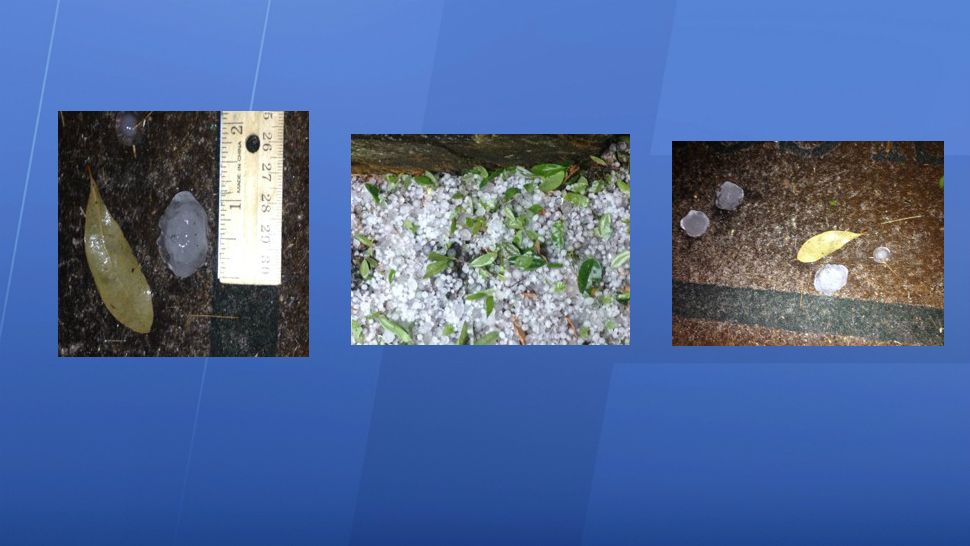
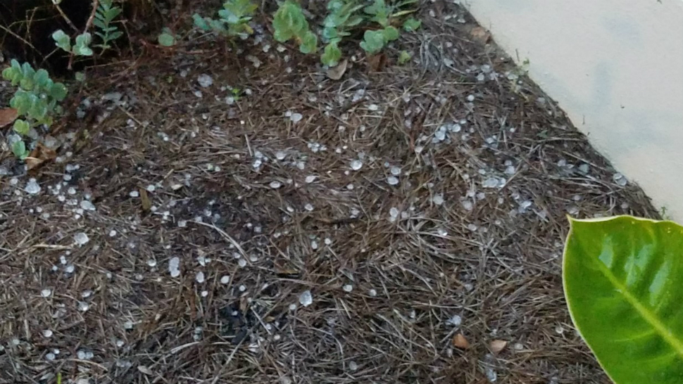
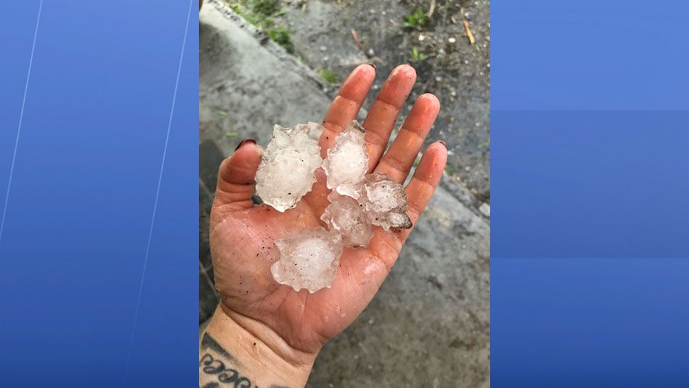
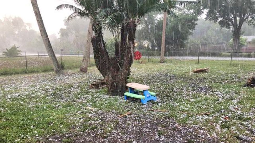
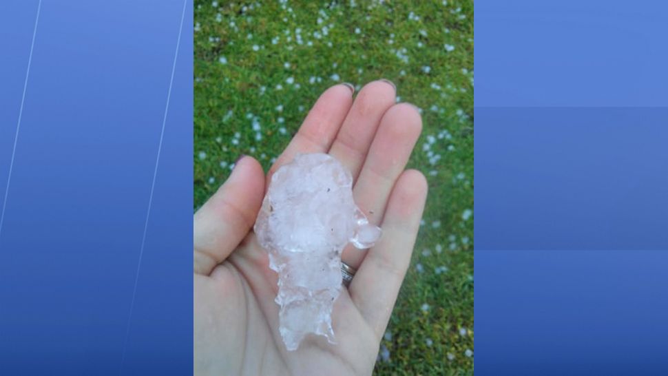
From Brevard to Orange and Marion counties, penny- to golf ball-sized hail deluged the area
In Indialantic in Brevard County, golf ball-sized hail fell into a home's backyard pool, making the water look like it was boiling.
In the Del Mar neighborhood along State Road A1A, hail shattered at least one home's windows and tore holes vinyl siding.
Traveling down S.R. A1A, quarter-sized hail lined streets, parking lots, and the sides of buildings.
"(It was the) first time I've seen hail like this in my life," Ken Dedis said. "It was amazing."
Many people were contacting Spectrum News 13 with the same thing this morning: How can hail happen in Central Florida?
— Spectrum News 13 (@MyNews13) March 27, 2019
Well, it can and our certified meteorologist @MalloryNicholls explains how.
Get your Central Florida forecast here: https://t.co/XAsSmjLqqn pic.twitter.com/nSoapXBrw7
In the parking lot of the Doubletree hotel on Eau Gallie Boulevard, several cars were left with shattered back windows.
Comprehensive car insurance policies typically cover hail damage, but a basic policy won't.
Brevard County Fire Rescue reported ice on the road in the Port St. John area at about 9 a.m., then the hail hit Cocoa and Rockledge.
The Brevard Humane Society's Cocoa adoption center on Cox Road has been closed due to damage it sustained. The humane society is accepting donations to return it to service. Its Merritt Island location on Pioneer Road is still open.
Tim Parker watched helplessly from his front door as hail pummeled his vehicle in his driveway.
"They may total it out, we'll see," Parker said. "It is what it is, nobody got hurt, so that's the main thing."
Northbound on Interstate 95, a hail storm caused drivers to pull over at about 10 a.m. The hailstorm lasted about 10 minutes.
Lifelong Florida resident Colby Tutterrow watched the hail fall from his office and said it was the largest hail he's ever seen.
HAIL YEAH: severe t-storm producing hail near I-95 and SR 528. Check our this video from Holly Carver! Looks like snow! Traffic is moving slow. 🚧💦🌫 @MyNews13 @MyNews13Weather @MyNews13Traffic @NWSMelbourne @SpaceCoastSkies @BrevardEOC @SpaceCoastTPO @FHPOrlando @BCFRpio pic.twitter.com/W2yuqpEQnA
— Greg Pallone (@gpallone13) March 27, 2019
"The size at first was pretty big, almost about golf ball size. It was about 10 minutes of that, then turned into BB-sized hail," Tutterrow said.
Space Coast Area Transit said that because of the severe weather, some routes would run late.
Along the Interstate 4 corridor in Orange and Seminole counties, storms caused severe flooding at several locations along the "I-4 Ultimate" construction zone. Steve Olson, a Florida Department of Transportation spokesman, said project contractor SGL Constructors cleared drainage inlets and pumped water at several sites. Olson said all travel lanes on I-4 were clear as of Wednesday afternoon, but SGL was making preparations for more possible rain.
WEATHER FORECAST
Meanwhile, nicer weather is expected for Thursday.
We are expecting a mostly sunny, windy, and warmer Thursday as highs climb well into the 70s. Sunshine sticks around Friday and Saturday with highs into the upper 70s and lower 80s.
- View LIVE Interactive StormTracker 13 Radar Map
- View our LIVE Sky 13 Weather Cameras
- Sign up for Severe Weather Alerts
We’ll go mostly sunny on Sunday as some puffed up cumulus clouds develop in the afternoon. They won’t slow us from heating into the low to mid-80s Sunday afternoon. The next system taking shape rolls across the peninsula Monday into Tuesday. Right now, the highest rain chance looks like Monday night. We’ll go from 80s Monday into the mid to upper 70s Tuesday.
BEACH AND SURF FORECAST
A solid northeast to east-northeast windswell and strong onshore wind will create dangerous ocean conditions again Thursday.
Gusts over 30 mph will create large, breaking waves of six to eight feet and even higher at times in the surf zone. Because of expected dangerous ocean conditions, a high rip current threat exists and red flags will be flying up and down our east coast. Enjoy the sun, but don’t forget sunscreen. Our UV index is very high, which means under 15 minutes for a burn.

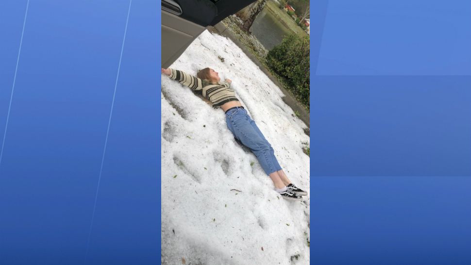
We want your pictures!
Show us what the weather looks like in your neighborhood. Your photo could end up on Spectrum News 13.
- Get the Spectrum News 13 app for iOS or Android
- Tap "Submit Content" at the bottom of the app menu
- Remember to include your name and location