


A cold front swept through central Florida heading into this weekend, bringing another shot of cold air. This is nothing we haven't already dealt with this dry season.
Temperatures will be in the lower 40s south of Orlando. Meanwhile, areas in Marion, Sumter, northern Lake and Flagler Counties will dip into the upper 30s. There will be enough of a wind to push wind chill values, or what it feels like on your skin, down into the 20s and 30s.
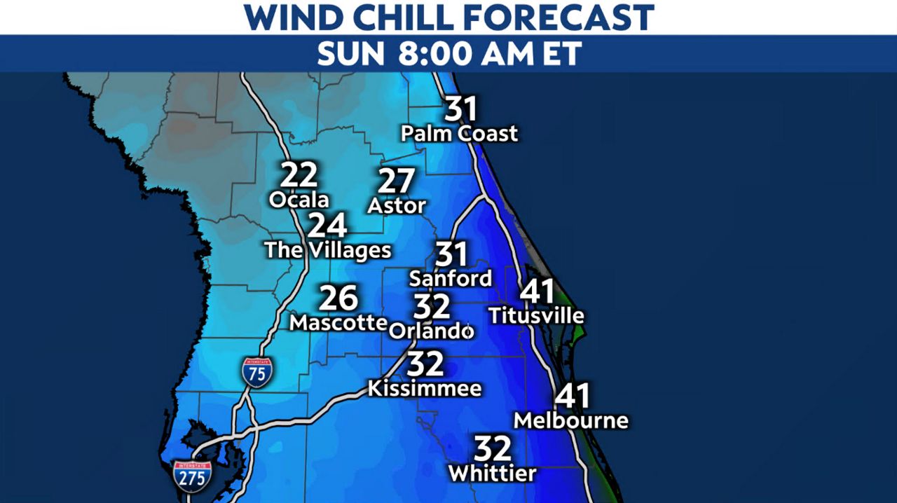
The coldest air will arrive Sunday morning. This is when more areas will see temperatures in the 30s. A freeze is possible for areas north and west of Orlando. A Freeze Warning is in effect for Marion and Sumter counties for Sunday morning.
Area wide Wind Chill Advisories remain in effect. Below are the expected wind chills for Sunday morning.
Skies will be filled with sun on Saturday and Sunday, but temperatures will only reach the upper 50s and lower 60s both afternoons. This is about 10 degrees below average.
Our team of meteorologists dives deep into the science of weather and breaks down timely weather data and information. To view more weather and climate stories, check out our weather blogs section.