More rain, wind and coastal flooding are expected this evening and tonight across central Florida.
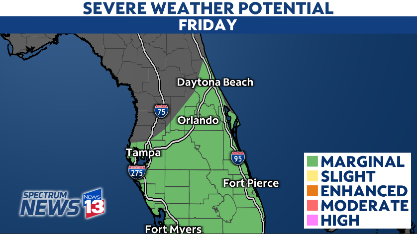
A powerful storm system will roll across Florida to close out the workweek, bringing rounds of rain and storms.
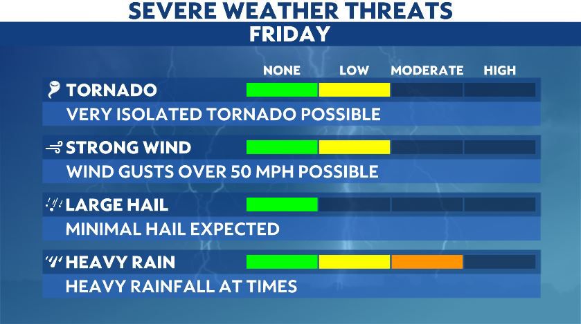
Some storms are still possible this evening, with the best chance for lightning south of Orlando. Some storms may still be strong with gusty winds the biggest concern.
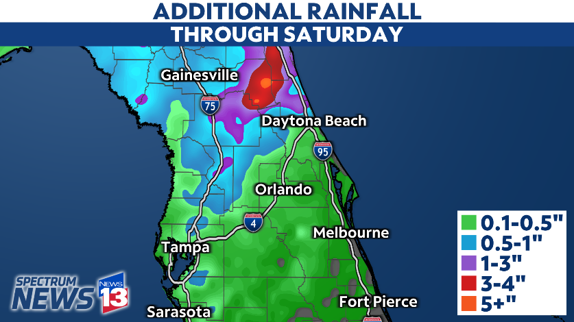
The other major issue will continue to be the potential for flooding rains. Some portions of central Florida may receive 3-5 inches of rainfall, which could lead to flooding issues.
Winds will also ramp up as this evening and tonight, creating concerns along the coastline.
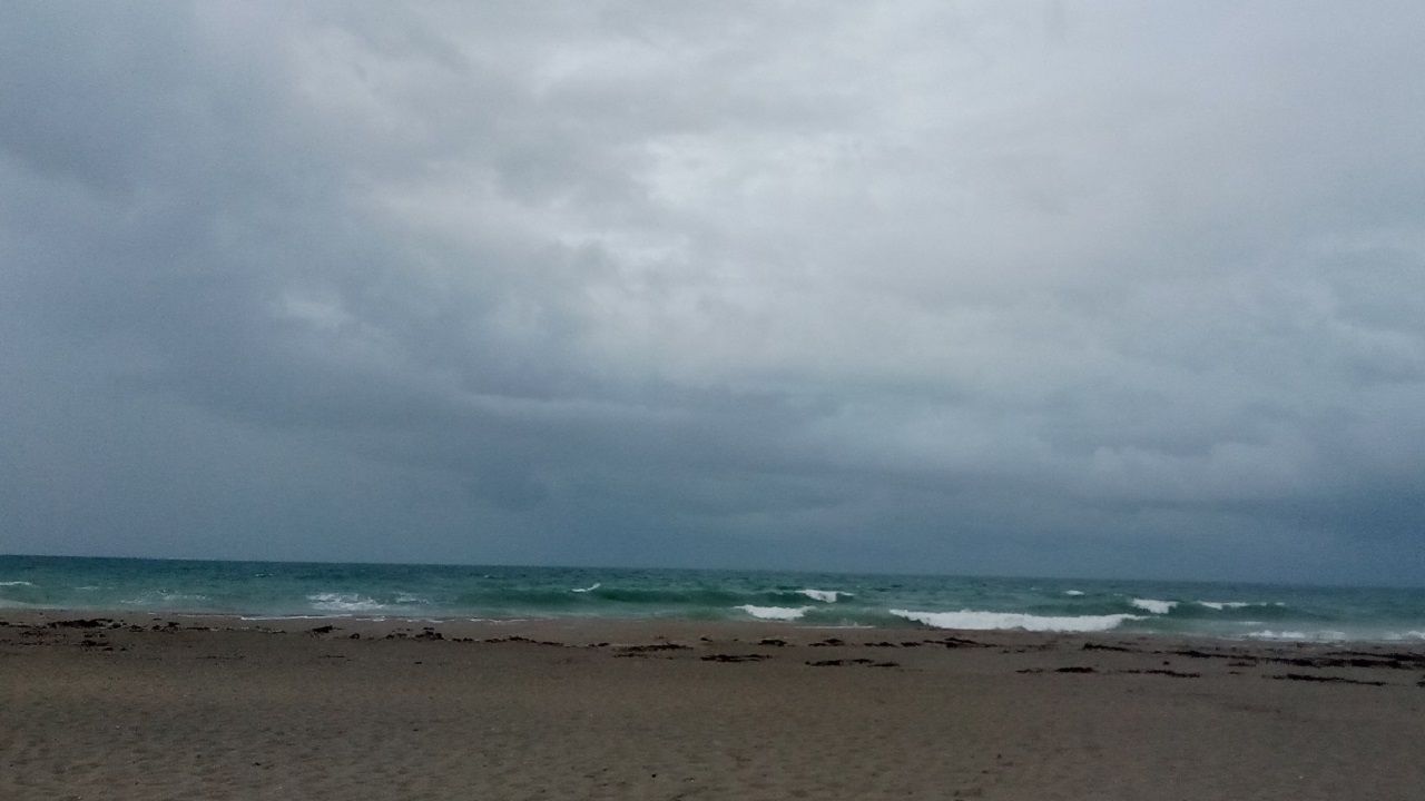
Most of the east coast beaches are under Coastal Flood Warnings and Coastal Flood Advisories for Friday into the weekend.
A High Wind Warning has been issued for coastal Flagler county, where wind gusts near 60 mph will be possible overnight into Saturday.
High wave activity and elevated sea levels will likely lead to beach erosion at area beaches this weekend.
While the storm system will begin to move away on Saturday, rounds of rain will continue during the morning hours. The heaviest rain on Saturday will likely be north of Orlando.
Check the latest view of Klystron 13 here. Stay with Spectrum News 13 for updates on this storm system.