


GOTHA, Fla. — In 2016, Scott Richman who lives on Lake Fischer began the process to build a walkway bridge and dock from the back of his home to the lake.
What You Need To Know
- Gotha has seen growing water levels in several lakes
- Home owners have been dealing with the headache of rising levels
- RELATED: Mysteriously Rising Gotha Lakes Force Residents From Dream Homes
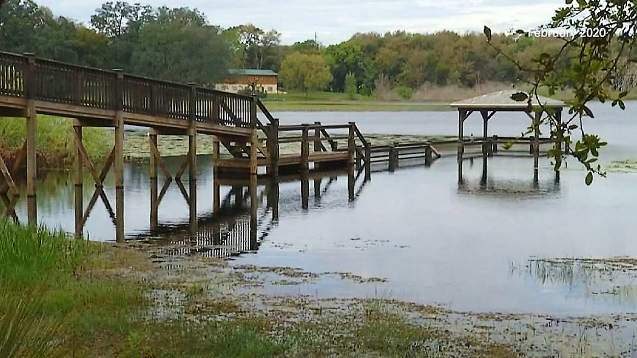
“The water level height wise was about 11 feet shallower,” says the Gotha resident as he stood from his dock that is partially under water.
Richman knows this because he went through the permit process with the county every step of the way.
“This dock was sort of my measuring stick, and when we built the dock it was eight feet above the water level," Richman explains. "Then we watched that tick up slowly, slowly, slowly until it was then three to four feet under water.”
Dr. Mark Rains says for water levels to change dramatically, it can be caused by one of two scenarios; development or by Mother Nature.
“We hadn’t been hit by multiple hurricanes in the last few months," Rains, a hydrologic sciences professor at the University of South Florida, said. "You might think, ‘Why is the water rising so quickly here and now when there is not a meteorological phenomenon responsible for it?’”
In October of 2017, the county even went to the Richman’s home and took photos of how the project was coming along with no notes of any problems.
“Per the county’s requirement, we had to build the dock one foot above the normal high water level," Richman recalls. "Normal high water level was 87 feet or 87 and change so we built that to 88 and change.”
Homeowners in a nearby neighborhood also on Lake Fischer went through a similar process and had the same results.
A resident of Lake Fischer Estates decided to reach out to the Florida Department of Transportation for information. Stephanie Eisenberg responded to Ryane Taylor on February 5, stating “The 76 inch by 48 inch cross drain was constructed as part of the western extension of SR 408, and was built to maintain the historic drainage pattern that existed prior to the construction of the extension. Water flowing from a pond located North of SR 408 travels through the cross drain to Lake Fischer.”
Camp Ithiel Director Mike Neff, who is familiar with the area and resides on Lake Fischer, started to investigate on his own where the water was coming from.
“I explored on another day and found that Hemple Avenue and its bridge over the expressway that feeds a retention pond that feeds a swale that feeds I don’t know, an official or unofficial retention pond, and down in this overgrown area there is standing water that flows to the pipe that flows to lake Fischer,” Neff explains.
“At least one goal of storm water management is human health and safety," Rains said. "Get the water away from here and get it to a place where temporary high water won’t flood anybody’s property.”
David Boers is a Gotha resident who has had his fair share of flooding issues. He also happens to be a developer and general contractor who understands both civil and building plans. He says that when looking at the building plans involving Lake Fischer, things were missed.
“You can clearly see in the engineering report in the 2003 phase of the project that they missed the storm water system from Saddlebrook," Boers points out. "The Hemple Road area flowing into their stormwater system on the Northside of the 408.”
In 2003, a St. John’s River Water management District Permit Submittal Package was published for FDOT’s Turnpike District prepared by Comprehensive Engineering Services, which stated: There is an existing ditch located along State Road 408 on the northwest side which originally collected off-site flows from the area adjacent of 408. With the construction of the saddle brook sub-division after 1993, the area was re-graded and the off-site flows are now conveyed and treated in the ponds located within the sub-division. The ditch appears to be unused.
What that all means is there has been unaccounted stormwater entering the closed basin bodies of water in Gotha.
According to the state and Orange County’s closed basin requirements, no additional stormwater can enter in to a closed basin water body or lake.