


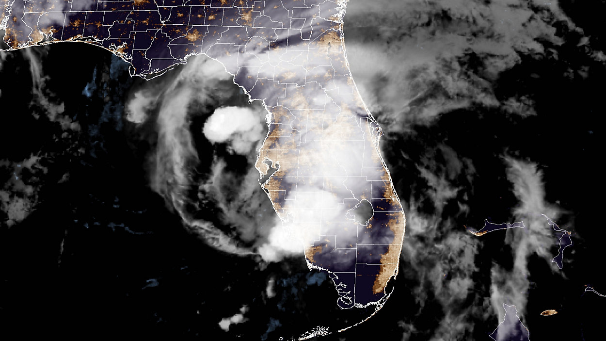
ORLANDO, Fla. — Elsa is making landfall in the the northern Florida Gulf coast as a strong tropical storm, with sustained winds of 65 mph.
What You Need To Know
- Sustained winds for Elsa were down to 65 mph early Wednesday morning
- Elsa continues to moving north at 14 mph
- Elsa making landfall in Taylor County
At 11 a.m. Wednesday, the center of Elsa was making landfall in Taylor County.
The storm is about 65 miles north-northwest of Cedar Key, and 100 miles west-southwest of Jacksonville, heading north at 14 mph.
Just after 4 a.m., a tornado warning was issued for north central Marion County that was extended to 5 a.m. A severe thunderstorm capable of producing a tornado was detected 7 miles southwest of Citra, moving northwest at 40 mph. Other locations impacted by this tornadic thunderstorm included Flemington, McIntosh, Lowell, Reddick and Micanopy.
In Lake County, a fast-moving storm with the potential for producing tornadoes was moving near Fruitland Park, Tavares and Eustis, prompting a brief tornado warning. It was heading north into Marion.
Earlier, a brief tornado warning was issued at 1:15 a.m. for mainly rural areas of southern Sumter, northeastern Pasco and southeastern Hernando counties. Radar detected rotation in a severe thunderstorm near Dade City, moving north at 40 mph. The warning expired at 1:30 a.m.
The storm will turn toward the north-northeast later this afternoon and eventually head ascross the southeastern U.S. through Thursday.
Tropical storm-force winds extended outward up to 90 miles from the center.
Check our Weather Alerts page for live updates on flood and storm watches and warnings.
Central Florida Impacts
The severe weather threat for Central Florida has diminished and the worst weather for the rest of Wednesday will be across northern Florida into parts of Georgia.
