


Alex remained a potential tropical cyclone until it moved east away from Florida.
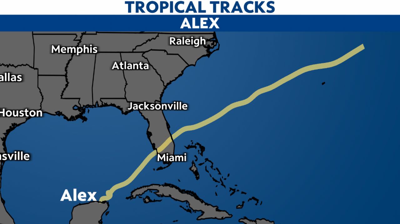
Alex became the first named storm of the Atlantic hurricane season after it brought downpours and flooding across South Florida and the Bahamas on Saturday. It formed early Sunday morning, June 5, in the Atlantic, just about 165 miles east-northeast of Fort Pierce, Florida.
Alex started as Agatha in the eastern Pacific, which formed early Saturday morning on May 28. It became a hurricane a day later before making landfall on Monday, May 30, in southern Mexico.
It fell apart into a remnant disturbance Tuesday morning before moving into the Gulf Mexico. However, the disturbance struggled to regain its strength as it moved towards the northeast.
While wind shear and drier air aloft actually weakened this lopsided system on its approach to South Florida from June 3-4, it still brought heavy rainfall and flooding.
The disturbance regained its strength and better organization upon moving off the Florida coast on the night of June 4 and became the first named storm of the season early June 5, Tropical Storm Alex.
Before the storm was Alex, it was Potential Tropical Cyclone One. The system brought flooding rains to parts of South Florida. Heavy downpours from the storm caused flash flooding in Miami.
In addition, the National Weather Service in Miami says several areas got more than a foot of rain from PTC One.

The storm also brought flooding rains to Cuba. Three people died from the storm that hit the island, according to the Associated Press.
The remnants of Hurricane Agatha killed at least 9 people in Mexico as the storm crossed over from the Pacific into the Gulf of Mexico.
A tropical disturbance crossing from one basin to the other isn't especially rare, although it's usually the remnants regenerating instead of an intact system surviving the crossing. And, the more common direction is Atlantic-to-Pacific, not vice versa.
For a recent account of remnants from one basin redeveloping in the other, that happened just last year. The Atlantic's Grace dissipated over Mexico, but its remnant circulation became Marty in the Pacific. In 2020, Amanda in the Pacific fell apart but led to Cristobal in the Atlantic.
Over the past 50 years, 12 tropical systems remained fully intact while crossing basins. The last was Otto in 2016, tracking from the Atlantic to Pacific. Going the other direction, the most recent storm was Hermine in 2010.
Follow along with us through the 2022 hurricane season to see what names we cross off the list.