


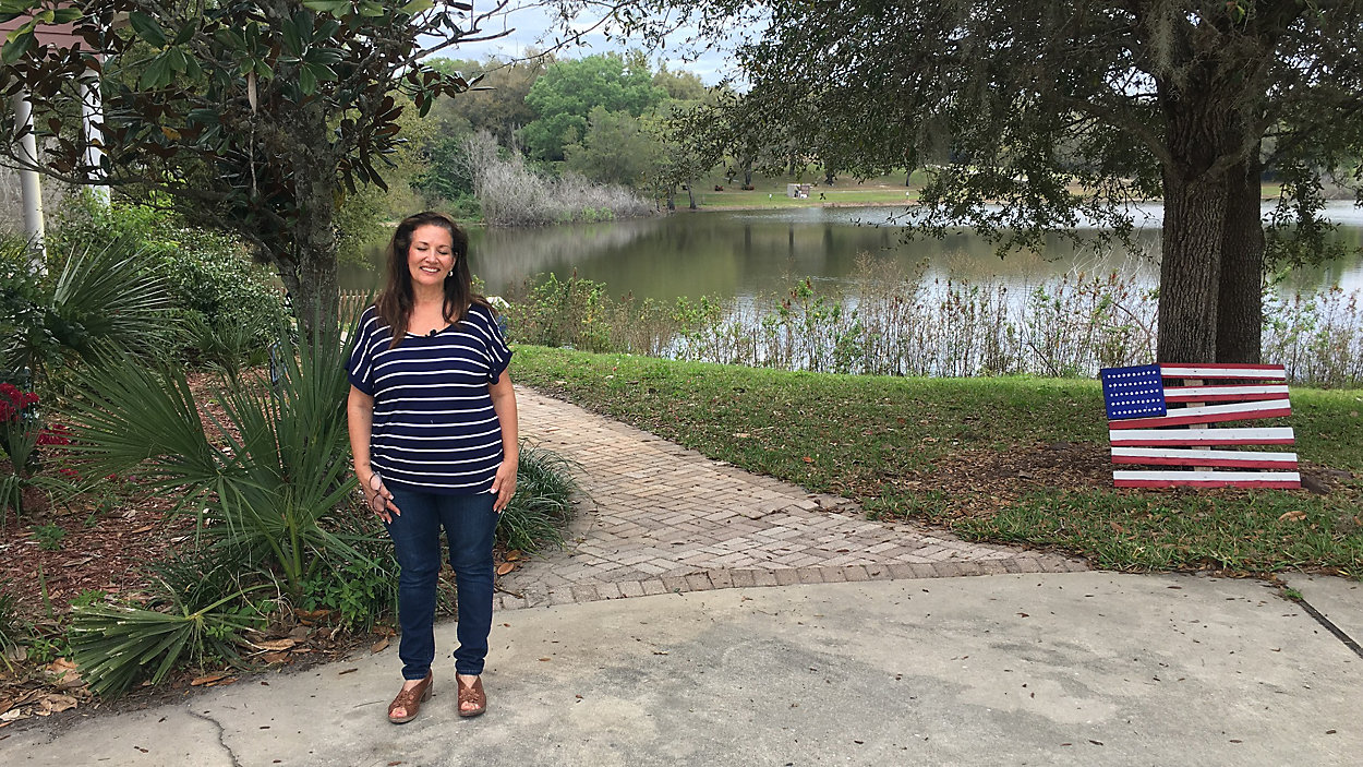
GOTHA, Fla. — Nancy Dougherty has lived on Gotha Pond for 20 years. In the last two, the view and the pond have changed dramatically.
What You Need To Know
- Gotha has seen growing water levels in several lakes
- Home owners have been dealing with the headache of rising levels
- FLOODING IN GOTHA:
“The lake was approximately 15-20 feet back then it is right now," said Dougherty. "It was filled with bass this large [hands held a foot apart].”
Her house, according to the county, was built to the base flood elevation it needed to be, which was set at just over 90 feet. A normal high water elevation for the area in 2001 was listed at 86 and a half.
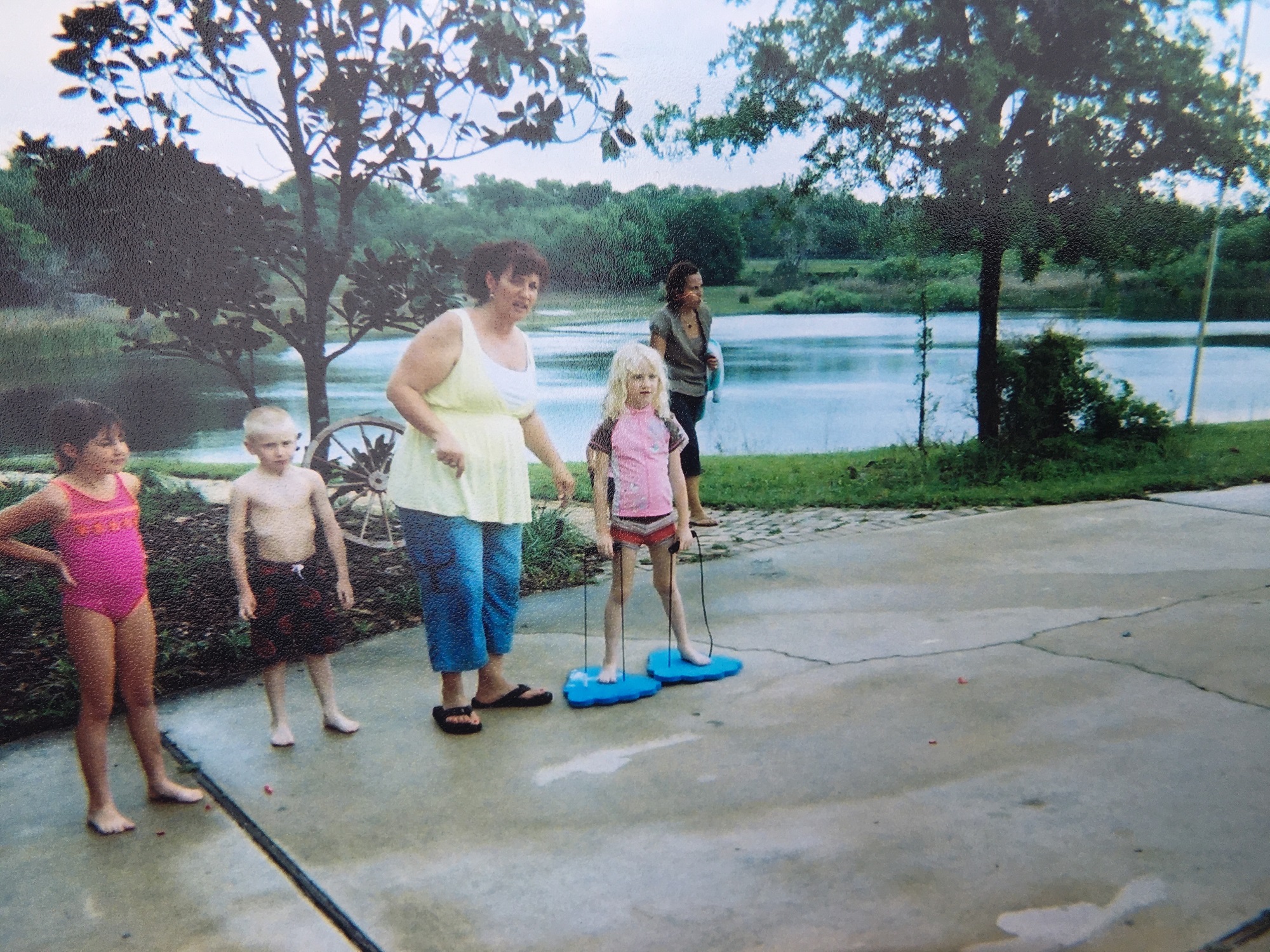
Gotha Pond 20 years ago. (Photo by Nancy Dougherty)
Almost 20 years later, her home is now in a flood zone and nearly 11 feet below the BFE, which the county changed in 2018.
The county never told her. Instead someone else gave her the news by mail.
“We started getting letters from the mortgage company," Dougherty remembered. "The banks said we needed to have flood insurance.”
Nancy was now in what’s called Flood Zone A, which means it's an undetermined flood zone according to FEMA.
At an Orange County Commissioners meeting in October of last year, after residents felt blindsided by the change to their BFEs, Commissioner Betsy VanderLey said on the record: “FEMA determines what that flood plain is. That we provide data to them, but they make that determination. I am getting nods from the back that I am right so that is good.”
But according to FEMA, that statement is not entirely correct.
“That is a Zone A, so FEMA has not established a flood elevation, so the county would have done that,” FEMA Senior Civil Engineer Mark Vieira said.
I could not get the county to sit and talk with me about the changes to the Base Flood Elevation for residents of Gotha on camera, but they did answer a few questions via email. When asked what caused the county to change the BFE in Gotha, their answer read in part:
“For the Gotha Pond area, the best current available source is the Lake Olivia Water Transfer Feasibility study which calculated the BFE as 101.7 NAVD. This community-accepted base flood elevation supersedes previous and less accurate base flood elevations.”
That’s a bit of a problem for the Temple Israel Cemetery, which when it was being built in 1988 was informed they had to build above the then-eater elevation line of 86.66.
“We have to think of this as congregational use for the next couple hundred years,” said Julien Miten.
Miten oversees the Temple Israel Cemetery, which happens to be Dougherty’s neighbor on Gotha Pond. One problem with the county changing the BFE is people who are buried 6 feet under can soon be underwater as well.
It's a message Miten says he relayed to Commissioner VanderLey.
“When I said the words 'if you cover up graves and people are underwater, that's a religious anathema'," Miten recalled, "Those are the words that came to my mouth at that moment and they all gasped. Because they understand what that could possibly cause lawsuit wise.”
A big cause for the small Gotha Pond to encroach on properties and rise is the pour-over from Mills Pond. The pond is over 300 yards behind Nancy Dougherty’s home, but seems determined to connect with Gotha Pond when Mills Pond overflows, and water needs somewhere else to go.
“We have had flash flooding, we have built berms, the berm broke," Dougherty said. "We were out there at one in the morning to stop water coming through. It was like being in quicksand; my legs got stuck and my husband and son had to pull me out.”
To try and stop water from Mills Pond, Dougherty had to build a new 12-foot-high berm to keep water from coming down her property on its way to Gotha Pond.
Between raising a well, owning dozens of sandbags, and a new berm, Dougherty is now out of ideas on how to keep her home safe from future floods.
“Its disheartening, I try to just move on and live my life as if maybe it's not going on, because I don’t have any other choice,” Dougherty said.
And down the pond, others hope their lives will be able to be honored and remembered.
“Its just unfathomable that a grave would be covered with water,” Miten said.
Spectrum News asked Commissioner VanderLey for an interview, following our interview with FEMA a few months ago. We told her office that FEMA said they did not set the Base Flood Elevation for Gotha Pond, and offered her a chance to correct her statement from that commissioners meeting last year.
VanderLey's office told Spectrum News that since the county was not commenting, they did not want to comment either.
In a recent Gotha Lakes Watershed Management Plan Update published for the county, it says that Orange County set the BFEs for Lake Nally, Mills Pond, and Gotha Pond.