


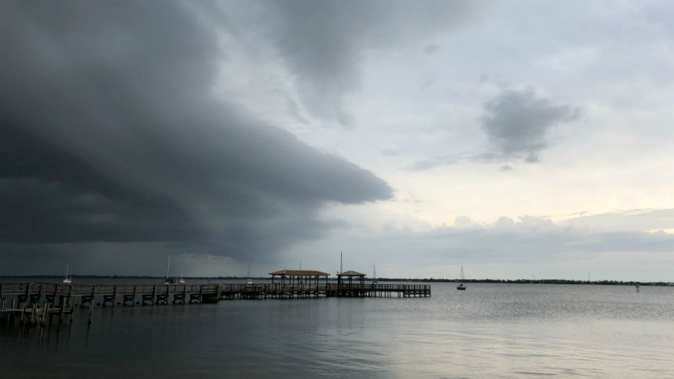
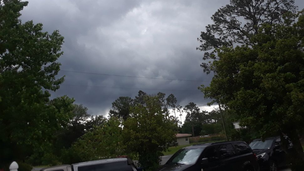
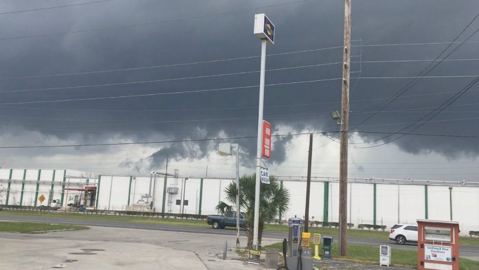
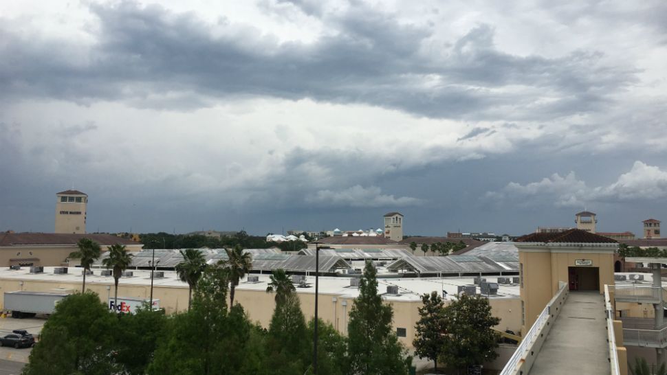
ORLANDO, Fla. — A line of strong storms crossed Central Florida today, triggering tornado watches and severe thunderstorm warnings in multiple counties.
- Severe thunderstorm, tornado watches were issued
- 8-year-old girl killed in Leon County after tree falls on home
- POWER OUTAGE MAPS: Interactive maps from major Central Florida power companies
- Send us your weather photos via the Spectrum News 13 app
- CURRENT CONDITIONS: Temperatures, heat indexes, trends
- SEE BELOW: See our 7-day forecast ▼
Most of northwest Central Florida was under a tornado watch until 4 p.m. as severe thunderstorm warnings were issued for many counties from the Tampa Bay area through Brevard County.
The storms were moving in a line that stretches from northwest to southeast across the peninsula of Florida.
The showers have come to an end across Central Florida Friday evening. Expect some cloud cover overnight tonight, with lows tumbling into the upper 50s and low 60s.
Latest Updates
6 p.m.: The severe weather threat has ended for Central Florida, and any warnings have expired as storms moved into the Atlantic. Wind advisories were still in place until 8 p.m.
4:29 p.m.: Severe thunderstorm warnings have been issued or extended for following counties and areas until 4:45 p.m.:
- Eastern Seminole County
- Northwestern Brevard County
- Southeastern Volusia County
- Osceola County
At about 4:10 p.m., a severe thunderstorm was spotted over Geneva and Lake Harney, moving northeast at 50 mph, forecasters said.
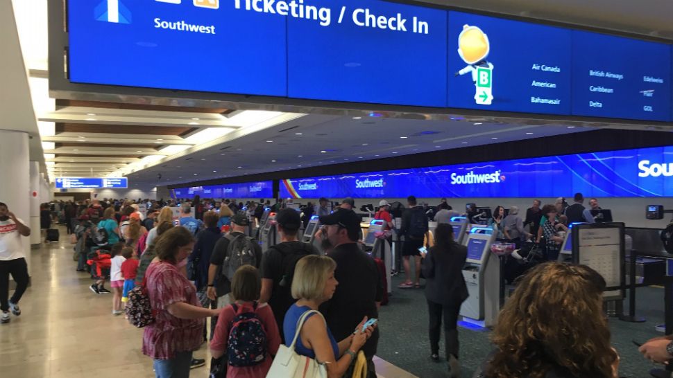
At Orlando International Airport, the FAA has instituted a ground stop. There are a few departures, however, for flights heading west.
4:22 p.m.: The tornado watch that had been issued this morning for multiple counties has been canceled.
2:45 p.m.: Our Spectrum News 13 Weather Experts say that the storm will roll across the metro Orlando area from now through about 3:30 p.m. The severe weather threat for Central Florida will be from now till about 7 pm. but should die down quickly.
Rain is still possible for the Orlando Magic pregame parties downtown, but the rain should be over by the time the playoff game ends.
A downed tree is blocking a southbound lane of Florida's Turnpike near Howey-in-the-Hills, the Florida Department of Transportation says.
2:30 p.m.: The severe thunderstorm warning in Flagler County has been extended until 3 p.m.
1:47 p.m.: Orlando International Airport is experiencing departure delays of 31-45 minutes and increasing, the Federal Aviation Administration reports. If you're traveling, check with your airline before heading to the airport. Spectrum News 13 Meteorologist Mallory Nicholls is at the airport and says no flights are being allowed to take off for about two hours.
1:30 p.m.:
Severe thunderstorm watches are now up for most of Central Florida, including Brevard, Volusia, Seminole, Osceola, and Orange Counties.
South of Ocala, an emergency management official reports that a tree is down and blocking an intersection at Southeast 90th Street and South Highway 475.
In Leon County, in a rural area south of Tallahassee, an 8-year-old girl was killed and a 12-year-old boy injured when a tree tore through their home. The boy has nonlife-threatening injuries, Leon Sheriff's officials reported.
Orlando International Airport officials warned travelers to brace for delays. The airport tweeted that flight and baggage operations will likely be affected.
Elsewhere
Saturday will feature drier and cooler conditions. Expect partly cloudy skies during the day with mostly dry conditions. Highs for Saturday will be in the low to mid 70s with still a gusty wind.
Easter Sunday still looks great across the area. The dry weather will continue with mostly sunny skies and morning temps in the 50s. Highs for Sunday will climb into the mid and upper 70s.
- View LIVE Interactive StormTracker 13 Radar Map
- View our LIVE Sky 13 Weather Cameras
- Sign up for Severe Weather Alerts
The great weather will continue into next week. Mostly sunny to partly cloudy skies are expected Monday and Tuesday, with highs in the low to mid 80s.
Warmer weather does return for the middle of next week, along with a few more clouds. A blend of sun and clouds will develop for Wednesday and Thursday, with highs back in the mid to upper 80s.
Rain chances will likely return to close next week, with temps in the mid to upper 80s.
Beach and surf forecast
A Small Craft Caution will likely be needed for Saturday, with westerly winds at 15-20 knots and seas 3-4 feet. Surfers will have poor-to-fair conditions, with a fading southeasterly windswell. The rip current threat is moderate for Saturday, with Atlantic water temps in the mid to upper 70s.

We want your pictures!
Show us what the weather looks like in your neighborhood. Your photo could end up on Spectrum News 13.
- Get the Spectrum News 13 app for iOS or Android
- Tap "Submit Content" at the bottom of the app menu
- Remember to include your name and location