


A large storm system in the Central U.S. brings it all as it trudges toward the east through the end of the week. From winter weather and blizzard conditions in the North, to severe weather in the South, widespread impacts from it will now shift toward the eastern half of the country.
The Northeast is next in line for areas of heavy snowfall the rest of the week into the weekend. Local totals will likely top a foot, especially in higher elevations.
The combination of all this winter weather will cause dangerous travel and some power outages.
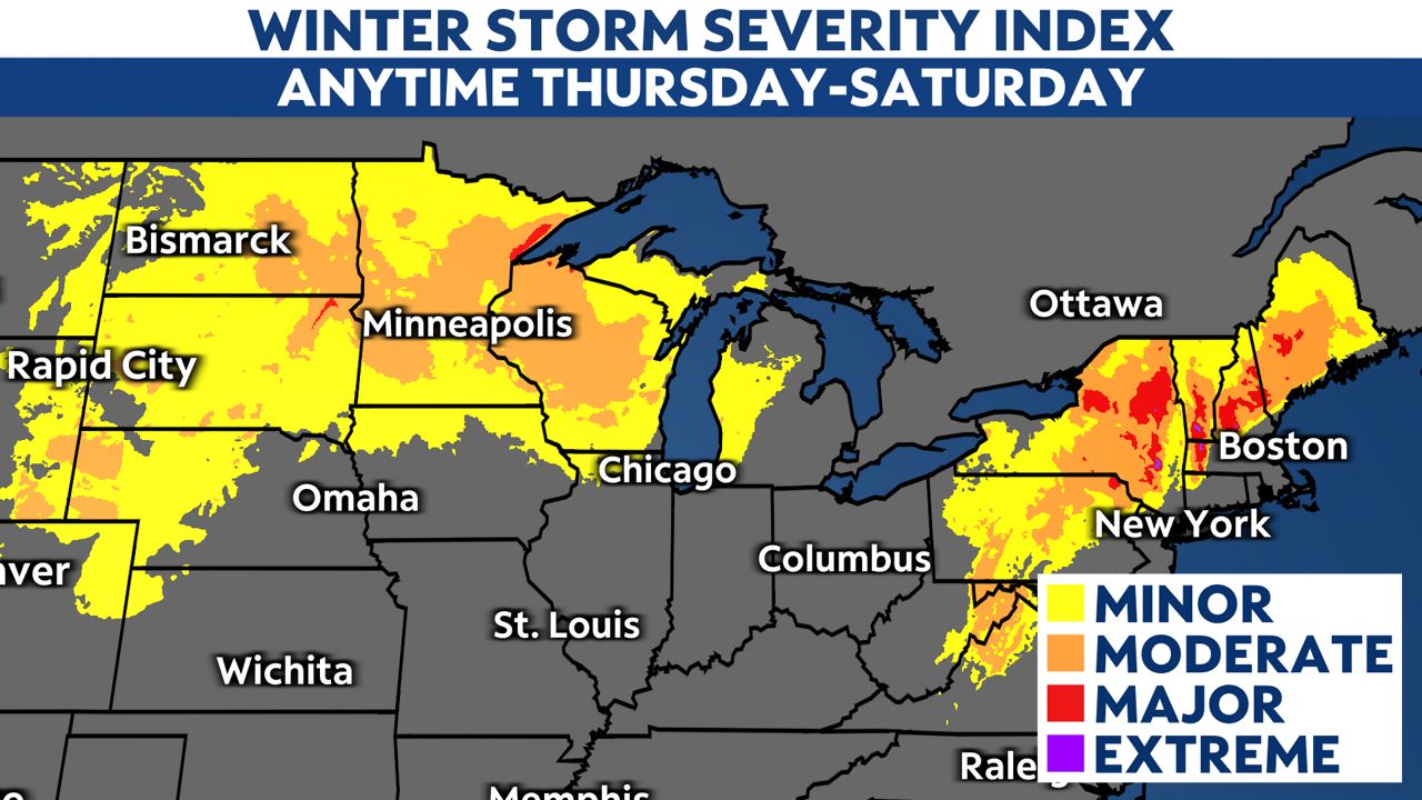
After dropping early-week rain and snow in the West, this system strengthened on Tuesday. Parts of the Northern Plains got over a foot of snow, while a wintry mix farther east led to about a quarter-inch of ice. Blizzard conditions finally end on Friday as strong winds finally back off. Some places in Wisconsin got over six inches of snow.
Meanwhile, the warm part of this system has produced quite a bit of severe weather. 14 confirmed tornadoes happened in Dallas area Tuesday morning, followed by more in the central Gulf Coast region on Wednesday. Storms are responsible for at least three deaths in Louisiana.
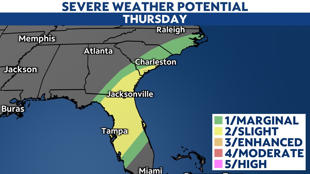
That cold front continues to press southeast, bringing the severe weather potential to the Carolinas down to Florida on Thursday. Strong winds and a few tornadoes will be possible in the strongest storms.
This system will also bring widespread rain and garden-variety thunderstorms to the rest of the eastern U.S. Rainfall totals in quite a few places will probably top an inch, with some in the Southeast even getting over two inches.
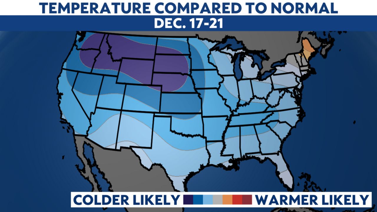
Noticeably colder air will follow this system as below-normal temperatures become common and probably stay put for several days.
Your local Spectrum News meteorologists have your forecast here. Stay ahead of significant weather by turning on weather notifications for your location.