


Throughout hurricane season, it does not take long for "weather enthusiasts" to start posting misleading information when it comes to the tropics.
That is why it is important to know what red flags to look out for on social media posts during hurricane season.
Reliable sources and forecasts will never make a post based on one model run alone without any context.
A post such as the one below, which shows a hurricane in the Gulf of Mexico about 15 days out, was only based on one model run and one model alone.
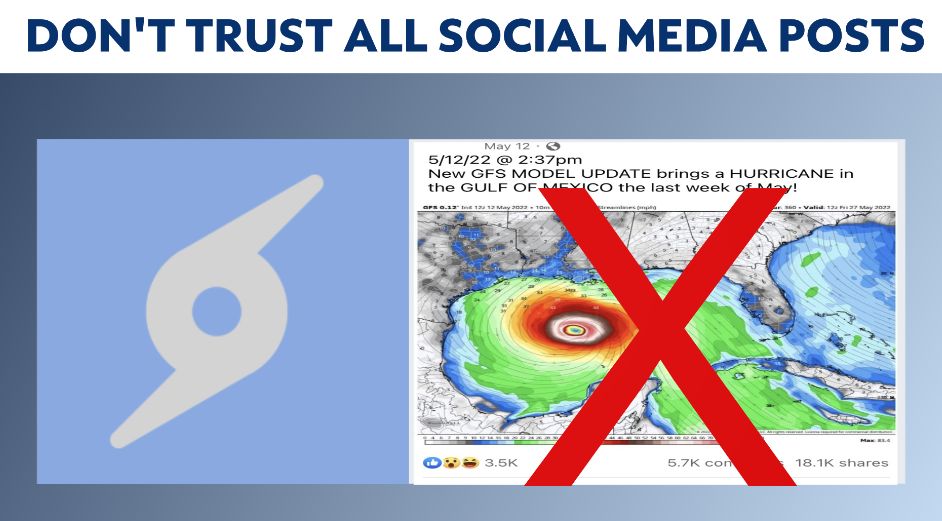
This is exactly the type of post and page to stay away from.
Reliable and knowledgeable meteorologists would never make a forecast based on one model and one model run alone.
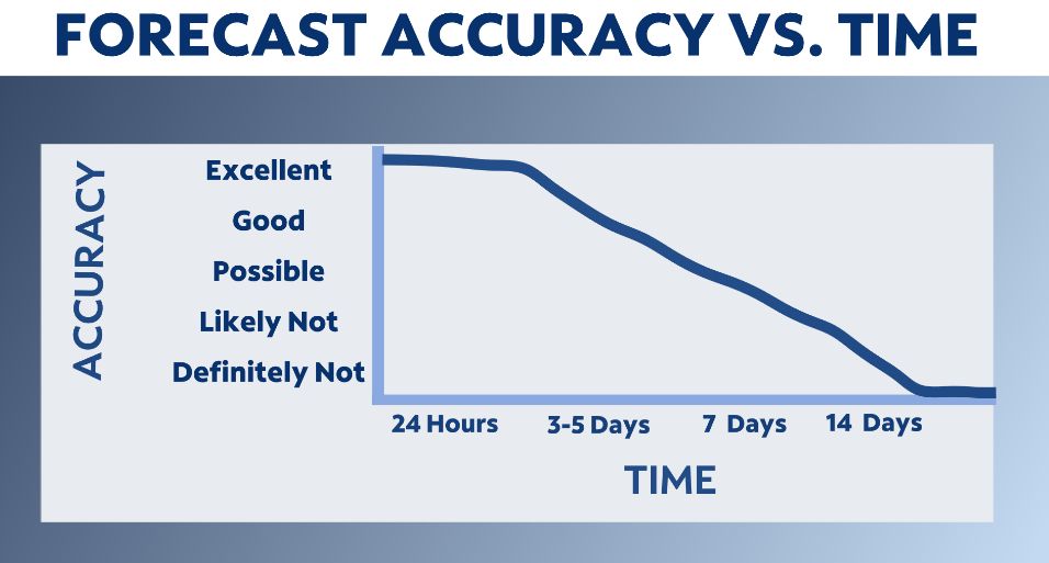
Nor would a responsible source post anything that was more than a week out due to forecast accuracy severely declining beyond five to seven days.
The models we use to make forecasts update every six to twelve hours, and their output can vary greatly from update to update.
For example, a morning run of a forecast model could show something in the tropics several days out. However, by the afternoon, the model could completely eliminate the possibility of anything developing.
This can happen from run-to-run or day-to-day.
It can also vary among the variety of models we look at to build forecasts.
Forecasts are based on model trends and a comparison of all models.
You often hear us compare the European and American models. These are the two main forecast models, but there are many others that we also analyze when building a forecast.
If the American model is showing tropical development several days out while the European model is showing no tropical formation, then it would be difficult to say for certain anything is going to happen at all.
Over time, we then continue to watch for the trends in the models to see if more than one starts to show potential development in a similar geographic region and time.
When more than one model picks up on something and the window of time gets closer, we can have greater confidence in the potential for a tropical system to form.
Forecasting tropical activity is tricky and it takes a lot of meteorological skill to make an accurate forecast.
This hurricane season, don't fall victim to the social media pages that only post one forecast model without context, and are posting the possibility of something happening more than a week out.
These pages are just trying to get views, likes and shares.
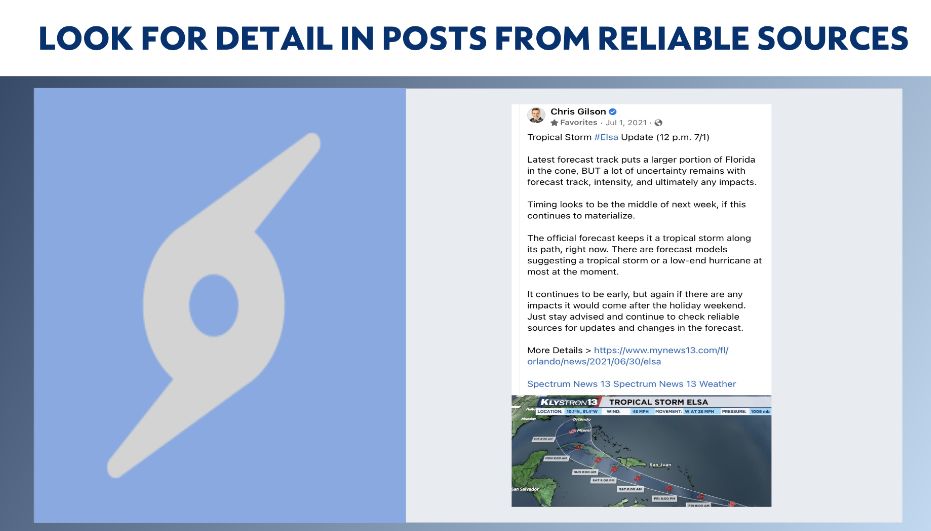
Rely on the team of meteorologists at Spectrum News and the experts at the National Hurricane Center for the most accurate information when it comes time to prepare for a potential storm.
Our team of meteorologists dives deep into the science of weather and breaks down timely weather data and information. To view more weather and climate stories, check out our weather blogs section.