


ORLANDO, Fla. — It will continue to feel like the middle of summer across Central Florida today. Afternoon temperatures will be closer to record highs rather than seasonal averages. High temperatures will be in the low to mid-90s inland with the upper 80s to near 90 along the coast.
- Warms temps, low storm chances
- Partly cloudy skies tonight
- Rain chances to increase Monday, Tuesday
- CURRENT CONDITIONS: Temperatures, heat indexes, trends
- TRACKING THE TROPICS: Formation potentials, Atlantic and Gulf satellite loops, typical storm tracks per month
- SEE BELOW: See our 7-day forecast ▼
“Feel like” temperatures will be around 100 degrees. It is important to take breaks in the shade, drink plenty of water, and don’t leave the kids or pets in the cars.
Drier air has moved into Central Florida which will keep storm chances extremely low today.
There’s only a 10 percent chance of a passing shower or storm today. Skies will be clear to partly cloudy overnight with low temperatures starting out in the mid-70s on Sunday.
The warmer than average temperatures will stick around for Sunday afternoon with partly cloudy skies. Easterly winds will usher in more moisture for a slightly better chance at a few storms for the second half of the weekend.
The coverage will remain low tomorrow. High temperatures will be in the upper 80s along the coast and lower 90s inland. “Feel like” temperatures will remain in the upper 90s to around 100 degrees.
The wind will start to kick up out of the east tomorrow afternoon. The wind will be 10-15 mph out of the east.
- View LIVE Interactive StormTracker 13 Radar Map
- View our LIVE Sky 13 Weather Cameras
- Sign up for Severe Weather Alerts
The breezy conditions will persist throughout the upcoming week. Temperatures do eventually fall closer to seasonal averages rather than the near record heat that we’ve been experiencing the past several days.
Storm coverage will jump back to 40 percent for Monday and Tuesday afternoon. Moisture will move in from the north and east. This weather pattern will provide Central Florida with a better shot at afternoon and evening storms.
Afternoon temperatures will be in the upper 80s for most of the region by Tuesday and Wednesday. Morning temperatures will be in the low to mid-70s by mid-week.
TROPICS
In the tropics, Kirk is now a remnant low in the Caribbean. Strong wind shear aloft has torn the storm system apart. It will still provide Puerto Rico with heavy rain today.
Leslie is a subtropical storm in the north-central Atlantic. This system poses no direct threat to land as it will continue to spin in the open waters of the Atlantic.
Some strengthening is expected during the next several days.
Swells from Leslie are affecting Bermuda and the northern Leeward Islands and they will reach other portions of the Lesser Antilles, Greater Antilles, and Bahamas through today. Swells are expected to reach portions of the east coast U.S. later this weekend. These swells will cause life-threatening surf and rip current conditions.
There are no other areas of concern at this time.
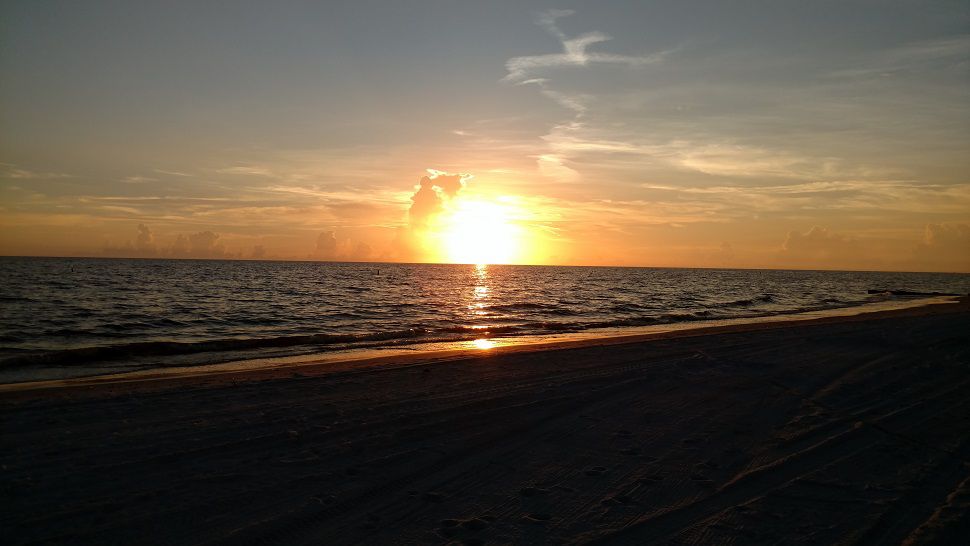
Your surf forecast today is for fair to poor surfing conditions. Wave swells will be 3-4 plus feet. The rip current threat is dangerous and high this weekend so it is best to swim within sight of a lifeguard. Water temperatures will be in the mid-80s and the UV Index is at an eight so be sure to apply and reapply the sunscreen. If you’re doing any boating, it will be mostly sunny and hot. Winds will be out of the east at 5-10 knots with seas of 3-4 feet and a light chop on the intracoastal.

We want your pictures!
Show us what the weather looks like in your neighborhood. Your photo could end up on Spectrum News 13.
- Get the Spectrum News 13 app for iOS or Android
- Tap "Submit Content" at the bottom of the app menu
- Remember to include your name and location