


ORLANDO, Fla. -- Potential Tropical Cyclone Seven has developed in the southern Bahamas.
The system is located approximately 275 miles east-southeast of Marathon, Florida.
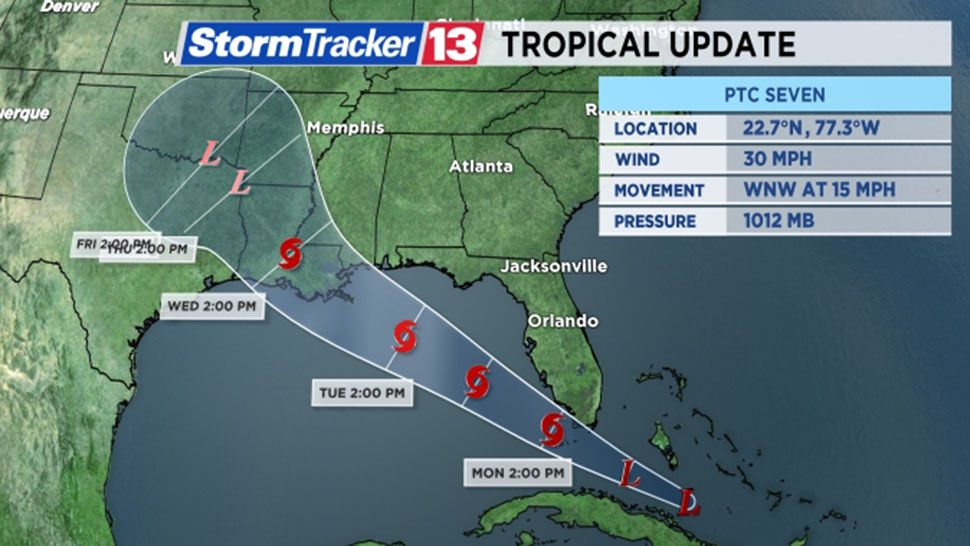
Maximum sustained winds are at 30 mph. It is moving quickly to the west-northwest at 15 mph.
- PTC 7 forms in the southern Bahamas
- Expected to bring heavy rain to South Florida
- TRACKING THE TROPICS: Watches, warnings, forecasts, spaghetti models
Tropical Storm Watches are in effect for portions of the northern Gulf coast, including:
*Alabama-Florida border westward to east of Morgan City, Louisiana, including Lake Pontchartrain and Lake Maurepas.
Potential Tropical Cyclone Seven is expected to become a tropical depression early on Labor Day, and will likely become a tropical storm late Monday night or early Tuesday.
If it becomes a tropical storm, its name will be Gordon.
Heavy rainfall and tropical storm force wind gusts are possible on Labor Day across much of South Florida and the Florida Keys. 2-4” of rain is possible, with isolated 8” amounts in South Florida.
Tropical storm force winds and heavy rainfall is likely Tuesday into Wednesday in the northern Gulf coast.
At this time, landfall is likely along the Louisiana or Mississippi coastline late Wednesday.
For Central Florida, enhanced rainfall and windy conditions are expected for Labor Day. The heaviest rainfall will likely fall south of Metro Orlando. Winds gusts over 25-30 mph will also be possible on Labor Day.
Elsewhere in the tropics, Tropical Storm Florence continues to move across the open waters of the Atlantic.
It is expected to remain a tropical storm in the open waters of the Atlantic through the middle of the upcoming week.